A Cultural Culinary Getaway in Messolonghi
A brave history and uniquely beautiful...
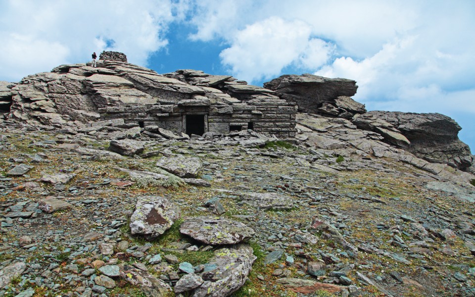
The largest and best preserved dragon house (drakospito), on the peak of Mount Ochi.
© Olga Charami
An intense uphill route will lead you to the peak of Mount Ochi, at an altitude of 1,399 meters, and to the mysterious Drakospito (dragon house), the largest and most impressive such structure in Greece. Arrive by turning left 3 kilometers after Metohi village along the Karystos-Platanistos road. Vehicles cannot go further than Kastanologos, the super-centenarian chestnut tree forest covering 600 square meters, with the enormous tree trunks resembling impressive human-made sculptures. Additional roads have recently been created to serve the nearby Aeolian Park (wind farm) but we insist on supporting the mountain’s hiking trails.
From Kastanologos the path continues to the Mount Ochi refuge, which is currently closed as it awaits much-needed repair. From this point the vegetation begins to thin out, limited to kermes oaks, and the terrain is intensely rocky. The view over the entire Karystias area opens up ahead of you as you reach the col, after which you ascend the sheer cliff towards the peak, which from there looks like an imposing fortress.
When you arrive at the chapel of Profitis Ilias, the peak is very close. The surrounding slopes are dotted with bizarre-looking grey buildings, such as the famous drakospita with its gigantic stone blocks and ornate construction and corbelling, all built without mortar. Archaeologists and historians have puzzled over this mysterious building and others like it for generations, unable to determine its exact purpose. Was it a site of ancient worship, an animal enclosure, or simply a residence for local quarrymen? Folklore offers a whimsical explanation, connecting the drakospita with dragons (or beings with superhuman strength), since they were the only ones strong enough to build them!
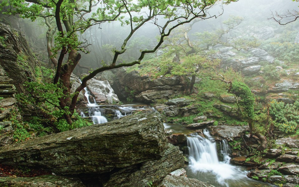
The Dimosaris gorge, an alternative route worth attempting.
© Olga Charami
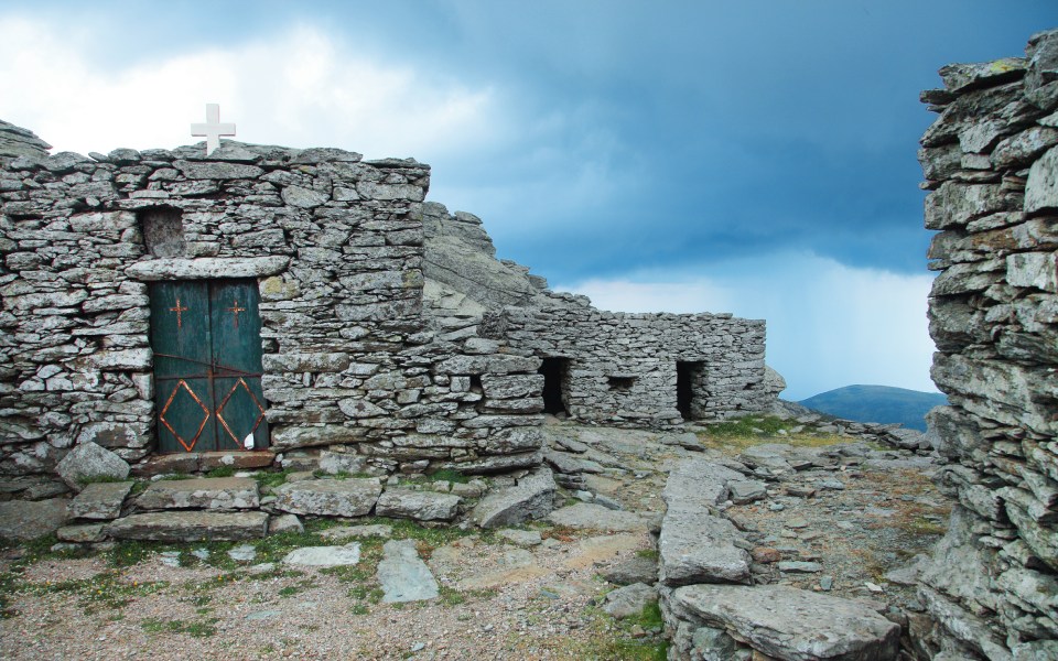
The chapel of Profitis Ilias and its auxiliary structures.
© Olga Charami
This route does not provide for many stops as there is hardly any shade. Nevertheless, the two most beautiful spots are located at the beginning of the route; shady Kastanologos, and the Ochi refuge dating from 1962, at an altitude of 1,050 meters. The water tap that operated on the patio does not work anymore, so be sure to bring along plenty of water. You may also make a stop at the col to admire and take pictures of Karystia from above while you regain strength for the final, steep uphill portion of the route. You may then take a break at the chapel of Profitis Ilias.
Also constructed from stones, as if mimicking the neighboring drakospito, there are various auxiliary structures and seating areas here. In fact, this is where a feast is held every August 2 in celebration of the Holy Prophet Elias (according to the old calendar).
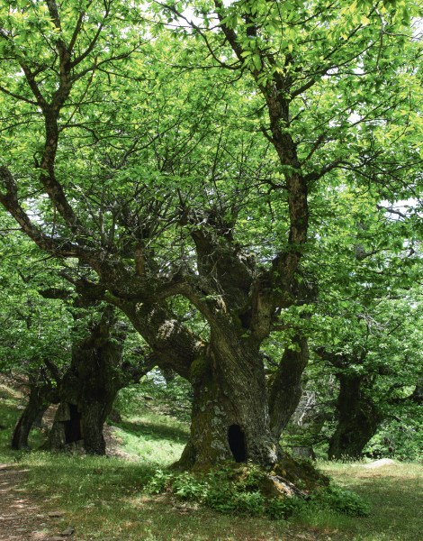
Kastanologos feels like a fairytale.
© Olga Charami
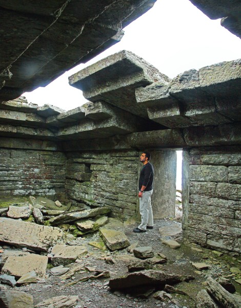
Inside the famous "Dragon House" (Drakospito).
© Olga Charami
Ochia in ancient Greek means “congress” and the mountain was thus named after the union between Zeus and Hera, which took place here. According to the myth, Zeus seduced the goddess in the guise of a cuckoo bird. She took him in her arms and he revealed himself to her, promising to marry her. In fact, one ancient source mentions the drakospito as a local temple dedicated to Hera.
The path is not particularly difficult and, since it is not long, is ideal for novices. The only thing that is needed is some stamina and some good orientation skills, as the cuckoos (heaps of stones signposting the route) often blend in with the rocky terrain. Even so, in places there are markers along the way.
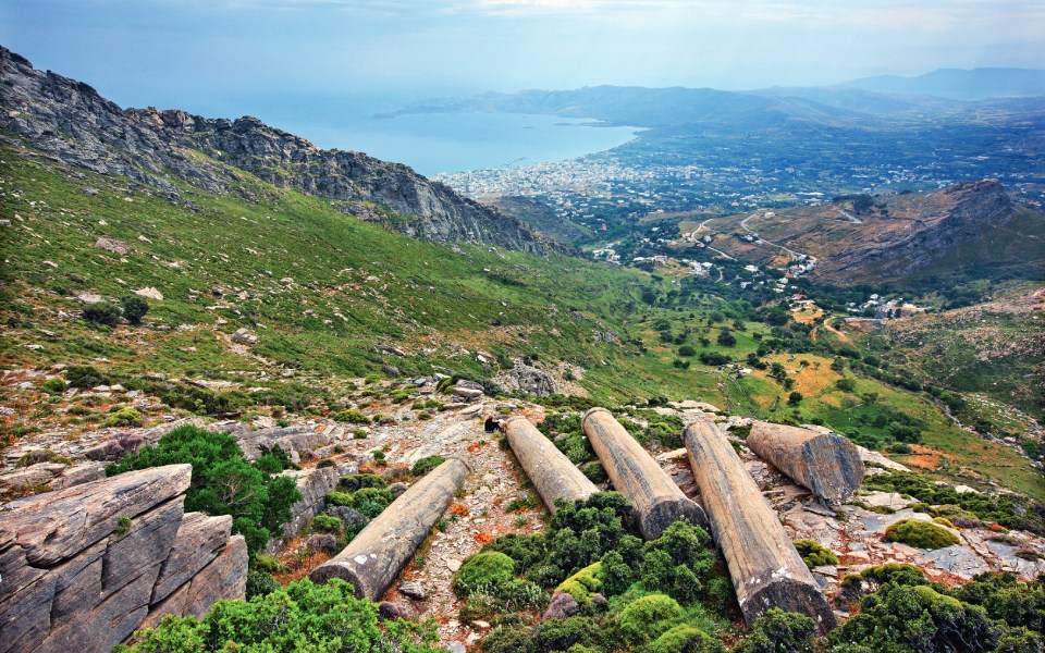
The Kylindroi of the ancient quarries and view of Karystos.
© Olga Charami
If you want to extend your hike, you can set off from Karystos and go up the hill via Mylos village. This route passes by the Kylindroi, abandoned columns from the ancient quarries. Even better, as you descend Mount Ochi it is worthwhile moving east from the col to reach Petrokanalo (where the road from Karystos leads to). From here begins a 10-kilometer path traversing the Dimosaris gorge, terminating at Kallianou beach, lapped by the Aegean Sea. This is one of the most beautiful routes on the island of Evia due to its wild vegetation, its windmills, its waterfalls and the Skala Lenosaion, an old pathway connecting the Cavo D’Oro with Karystos.
The route is 2.5 kilometers in length, and can be completed in 1 – 1 ½ hours. The section from Kastanologos to the refuge takes about 10 minutes. The incline is steep, starting from an altitude of 1,050 meters and ascending to 1,399 meters.
A brave history and uniquely beautiful...
The imposing mountain range of Agrafa...
Vargiani on Mount Parnassos offers stunning...
With its lush riverbanks, fine museums,...