Evia or Boeotia for a Day Trip?
City or mountain? Urban strolls or...

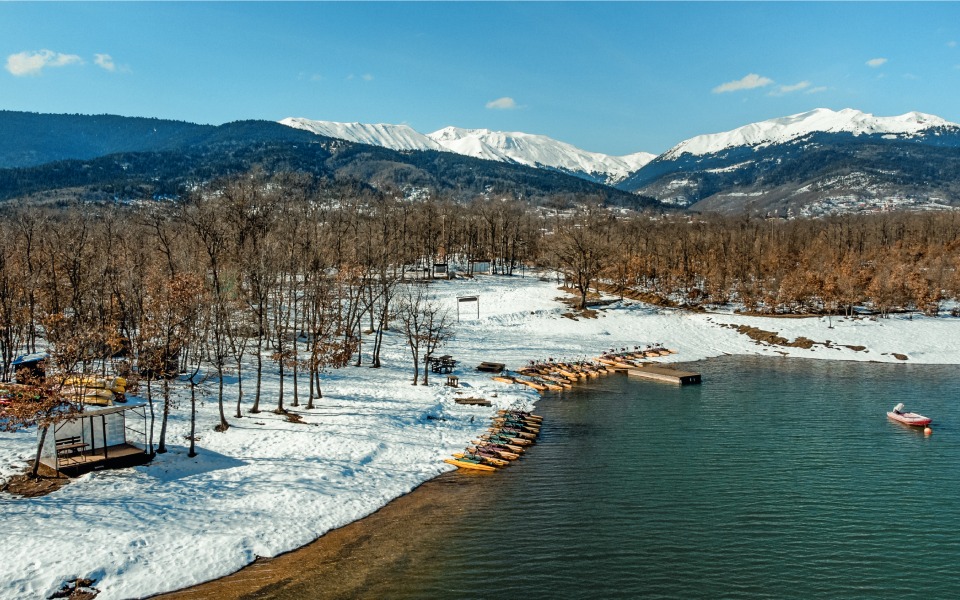
At Kalivia Pezoulas you will find a variety of activities for young and old, both on the lake and further afield.
© Nikos Karanikolas
This long route, spanning 208 kilometers, “embraces” the untouched mountains of Agrafa and approaches them from both directions: from Lake Plastira in the north, where the Thessalian Agrafa are also located, and from the villages of Karpenisi in the south, traversed by the Tavropos (or Megdovas) river in Agrafa Evrytania.
The southwest side of the lake is an ideal starting point, as it is the most developed. Pezoula, Neraida and Neohori are villages built by the lake, with great views and verdant vegetation. The artificial lake was created in 1959 with the completion of the dam on the south side, at the beginning of the Tavropos River, on the initiative of general Nikolaos Plastiras, who hailed from the area. It is used to supply water to the villages and the town of Karditsa, to irrigate the valley and to produce energy at the small hydroelectric power plant located here. At Kalivia Pezoulas you will also find companies that organize activities in the area, from cycling and canoeing to hiking and archery.

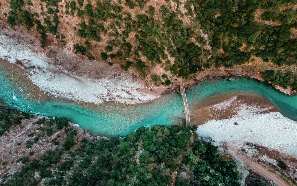
The Tavropos River in Agrafa Evrytania, flowing under the old, stone bridge of Viniani.
© Nikos Karanikolas
Looking for the riverbed of the Tavropos, you will leave the Regional District of Karditsa in the direction of Karpenisi, only to find it again on the foothills of the south side of the Agrafa mountains. It is no surprise that this specific part of Evrytania was a type of terra incognita until recent years.
The enormous mountains surround its few villages and the challenging road network made the area inaccessible for most. Besides, the Tavropos River is one of the most mountainous rivers in Greece. It springs from Thessalian Agrafa, forms Lake Plastira and continues its course until Lake Kremasta. Along its 78-kilometer course there are only a few points of access to the riverbed, as a large section traverses hard to reach landscapes. The iron bridge, almost 5 kilometers from Nea Viniani village, is one of these. From this point the Tavropos continues south until reaching Lake Kremasta, which flows there to meet three others – the Acheloos, Agrafiotis and Trikeriotis rivers. Cross the iron bridge and head north, leaving Nea Viniani behind you and in approximately 4 kilometers you will arrive at the old, stone bridge of Viniani.
The final section of the route is a dirt road and, if it has rained recently, it would be preferable to leave your vehicle and proceed on foot. Until the iron bridge was constructed, this was the only crossing over the Tavropos in Evrytania. The stone-built, single arch bridge is dated to the second half of the 17th century and it was most probably built by craftsmen from Epirus. It measures 33 meters in length, 8,5 meters in height and is part of the E4 European Long-Distance Path, connecting Nea Viniani with Stenoma, a village across the way. From here you can return to Karpenisi for some rest or head northwest to Lake Kremasta.

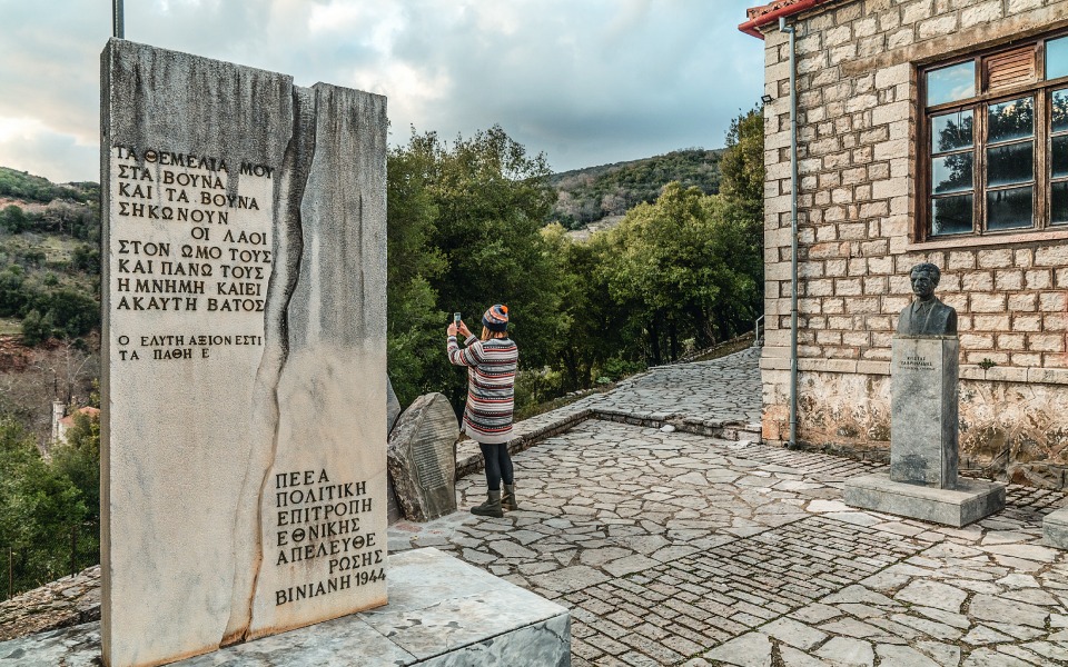
The old school in Viniani, where the Mountain Government was established, has been converted into the Museum of National Resistance.
© Nikos Karanikolas

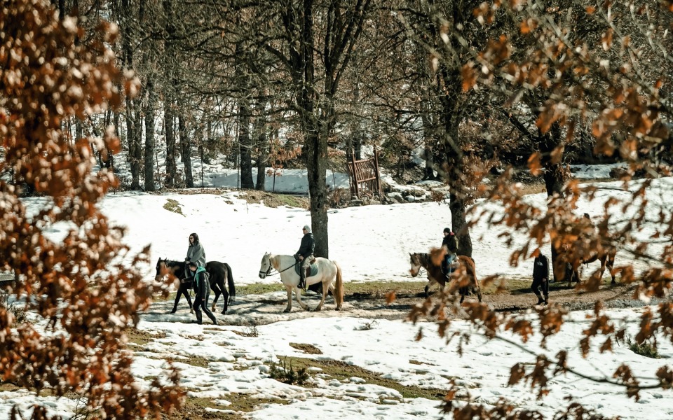
Horse riding under the trees on the snow-covered banks of Lake Plastira.
© Nikos Karanikolas
At Lake Plastira, the company Tavropos (tel. 24410-92552) organizes a variety of activities with Kalivia Pezoulas as their base. At the company information point you will find maps, travel and information guides. The cycling routes around the lake and the water bicycle are some of the best experiences, weather permitting. They also organize hiking trails in the wider area.
In the old school at Viniani, on 10 March 1944, the Political Committee of National Liberation was formed, also known as the Mountain Government. This is also where regiments of ELAS (Greek People’s Liberation Army) and EDES (National Republican Greek League) set off from to blow up the Gorgopotamos Bridge, in November 1942. Today the old school houses a small Museum of National Resistance – ask for the key at the kafenion (traditional cafe) in Nea Viniani.
The Hani Megdova taverna operates next to the iron bridge of the Tavropos River (tel. (+30) 6974.333.535), which is famed for its butter-fried trout and its well-grilled meats.
City or mountain? Urban strolls or...
One of the most rewarding road...
What do kiwis have to do...
We spent seven days at Nefeli...