Underwater research on the east coast of Salamis continued in July 2022, for the seventh consecutive year, within the framework of a three-year program (2020-2022). The project, a collaboration between the Institute of Underwater Archaeological Research (I.EN.A.E) and the Ephorate of Underwater Antiquities of the Ministry of Culture, comes under the direction of Dr. Angeliki G. Simosi. In addition, Yiannos G. Lolos, Professor Emeritus of Prehistoric Archaeology at the University of Ioannina and member of the Board of Directors of I.EN.A.E, with Dr. Christina Marampea as main collaborator, serves as field and documentation manager, along with the participation of archaeologists, other specialists and technicians.
According to a recent announcement by the Ministry of Culture, it is the first interdisciplinary underwater research carried out (since 2016) intensively by Greek institutions, in area of the historic maritime strait between the mainland and Salamis island, specifically in the coastal area of Ampelaki-Kynosoura. The 2022 underwater survey was successfully carried out by a 12-member team on the northwest side of today’s Bay of Ampelaki, where submerged remains of the Classical city of Salamis have been systematically investigated in recent years, including large parts of the sea wall, 3-4m thick, and other public structures.
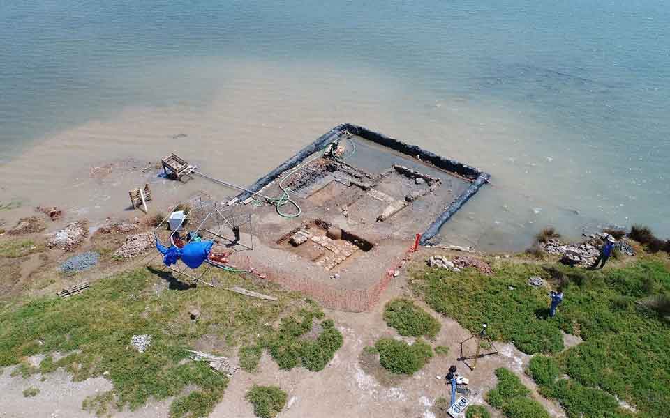
An area of particular interest has been the excavation of a large oblong public building, partially submerged, orientated in a general North-South direction. The building is located in the northwest cove of the Bay, in an area enclosed by the ancient sea wall (from the south and east), whose course has been fully documented in previous surveys.
The investigation of the building, based on a survey grid using 4 x 4-meter squares, was carried out again with the application of an “amphibian” excavation process, combining methods and techniques of terrestrial and underwater archaeology. This was achieved by installing a coffer dam around the site and using two water pumps, extracting the sea water in a total area of 60 square meters.
The building, with a width of 6m and a length of 32m, continues under the sediments to the north, on the seashore, and exhibits a square projection (wing) at its southern end. Based on the size, shape and layout of its spaces, as well as other architectural elements, the revealed building presents all the characteristics of an ancient stoa (arcade), according to the announcement.

© Hellenic Ministry of Culture
Its interior includes a series of at least six or seven rooms, in which one, with internal dimensions of 4.7 x 4.7m, a large storage jar was discovered in its northwest corner. Of the building’s outer walls, made of large stone blocks approximately 0.60m thick, only one or two layers of stone are preserved. The excavated section of the western long wall and the transverse internal walls reveal a solid, well-built foundation.
The ancient ruins, along other adjacent structures in the area of the Bay of Ampelaki, have been largely stripped of their masonry. Until the end of the 19th century, the area was heavily exploited for construction materials, for use on other buildings on the island and nearby mainland. Nevertheless, the excavation of the partially submerged ancient stoa has yielded numerous portable finds, including a large quantity of pottery from various periods. Significant amounts of pottery from the Early Byzantine and medieval-early modern periods were recovered from the low-lying marshy sediments.
The ceramic finding related to the operation of the building include abundant fragments of pottery of various types, dated to the Classical-Hellenistic periods. More important is the set of Athenian black-painted vessels from the Late Classical period (4th century BC), found on the floor level of the building. Many clay objects were also collected, including amphorae caps, as well as fragments of marble objects and 22 bronze coins, from Athens and elsewhere.

© Hellenic Ministry of Culture
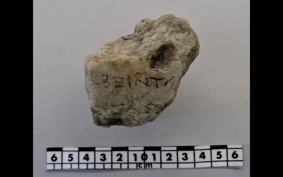
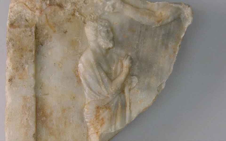
Of the marble finds, two are of particular importance. Both dated to the 4th century BC, the first is a fragment of a column with part of an inscription, in two or three fragmentary verses. The second fragment, which would have formed the upper part of another column, reveals part of a relief, depicting the muscular right hand of a large figure, probably a hero (Ajax?), crowning an upright bearded man. The scene refers directly to a similar relief representation on a marble stele from about 320 BC, on display at the Archaeological Museum of Salamis (MP 4228), depicting Ajax, an important hero in the epic cycle of the Trojan War, long associated with Salamis, being venerated at the ancient festival of Aiantia.
The discovery of the stoa is a crucially important element in the ongoing study of the topography and residential organization of the ancient city of Salamis. The building is open to the west and probably marks the eastern boundary of the Agora of the Classical-Hellenistic city, which would have extended to the west-northwest of the building. The stoa was described by the ancient geographer and traveler Pausanias (1.35.3), sometime in the middle of the 2nd century AD. Furthermore, it is precisely in the area, i.e. the low southwestern part of the Pounta peninsula, that W. Kendrick Pritchett had proposed for the location of the ancient Agora in 1959, based on earlier observations made by A. Milchhöfer (1895).
Source: ANA-MPA


