From Land to Table: The Culinary Riches of...
Cretan cuisine lives on from home...

Kamares, Koufonisi.
© Giannis Chatziioannou
UNESCO’s Global Geoparks network features 177 areas in 46 countries, including seven in Greece. Two of those are located on the island of Crete: the Psiloritis Geopark, covering an area of 1,272 sq. km in central Crete, and the Sitia Geopark, covering 516.7 sq. km in the eastern part of the island. They boast mountains and forests, canyons and coasts, interesting geological formations, rare species of flora, and landscapes of great natural beauty. These areas are also home to historical monuments dating back to various periods, as well as unique customs and cultural traditions. All of these things are criteria considered for an area to become a UNESCO Global Geopark. The quality and services provided within them are rigorously evaluated every four years, giving extra incentive to those in charge to protect and promote their areas.
During our tour of Crete’s two Geoparks, we enjoyed the lush nature with its rare forests, gorges, rivers, and lakes. We were charmed by the unique geoheritage and visited impressive caves, waterfalls, and golden beaches, as well as wonderful human constructions, from water mills and dry-stone walls to Venetian settlements and historical monuments. The Cretans were always hospitable, played the lyre and violin for us, danced their traditional dances, and showed us how they make cheese and their famous raki.
Ten of the best experiences we had in the two Geoparks are presented here:
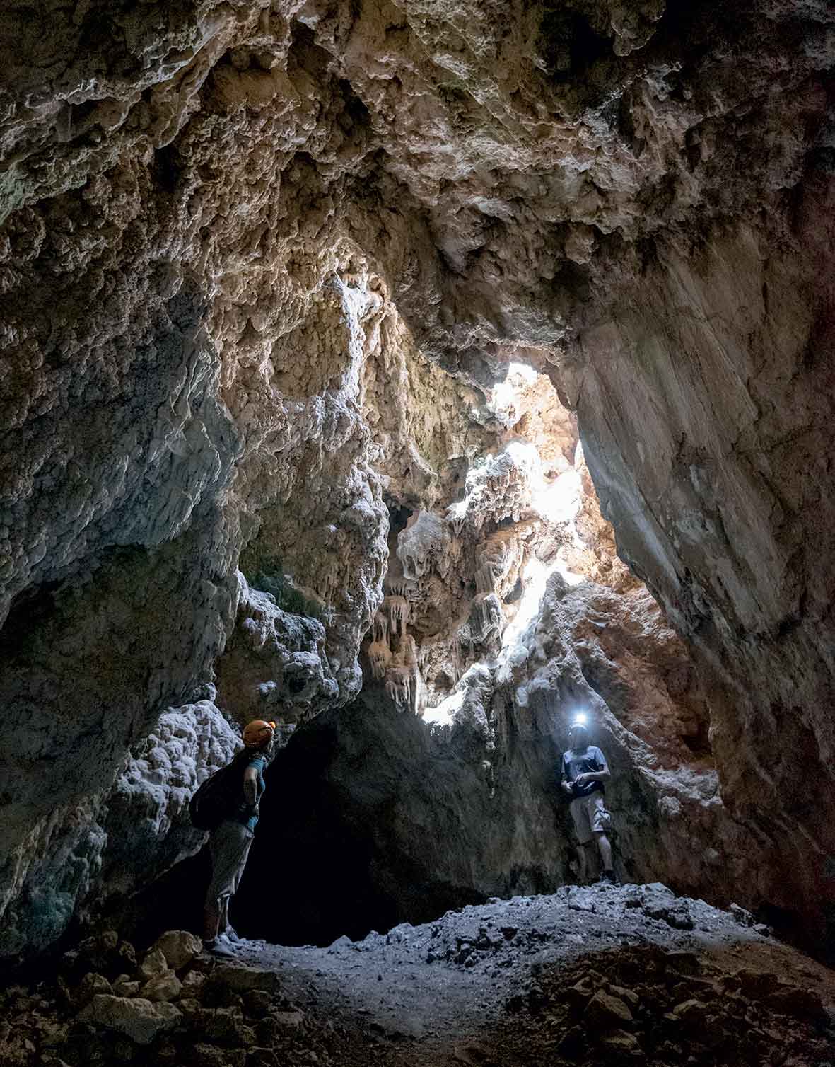
Cave of Vreiko
© Giannis Chatziioannou
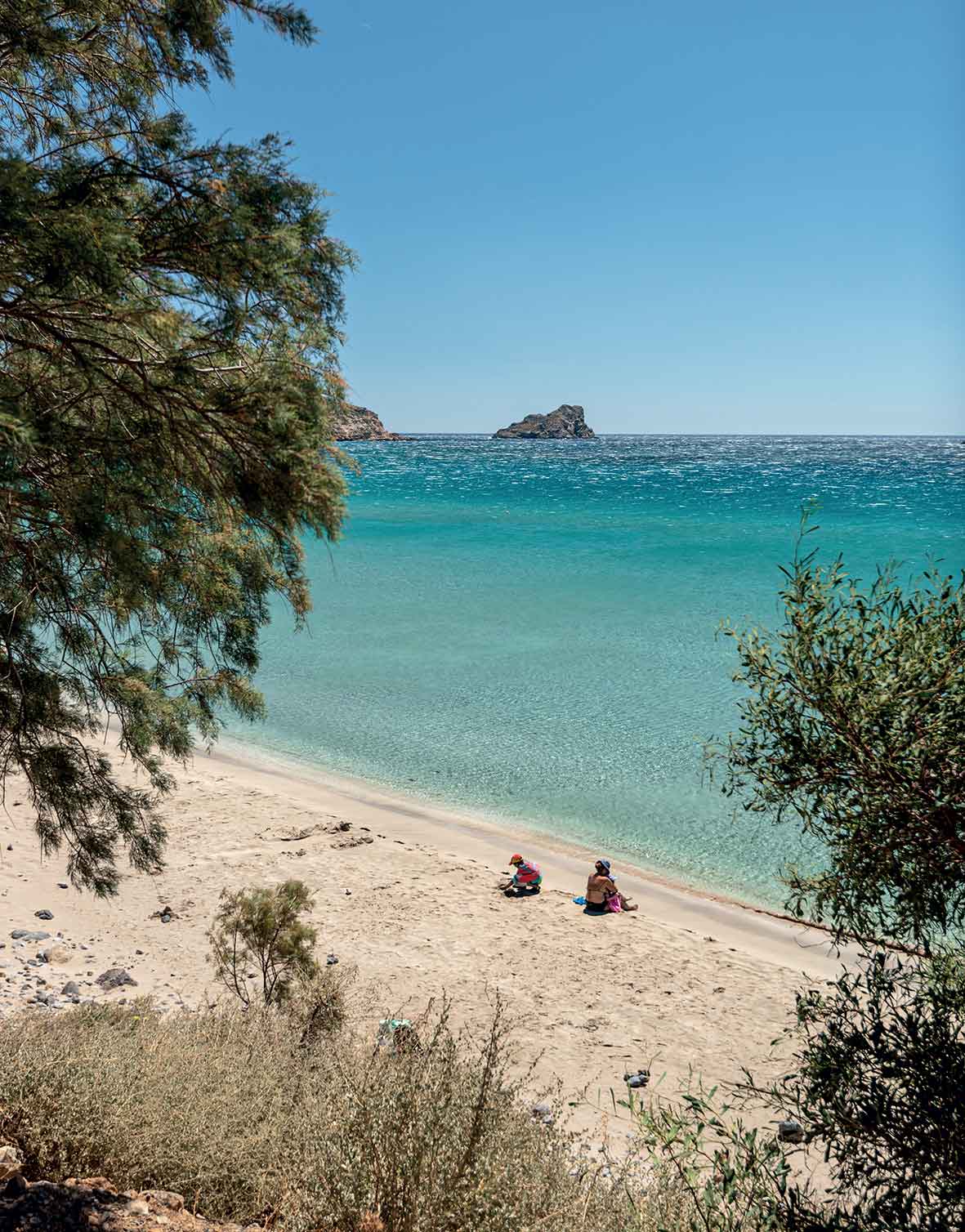
Ammos, Xerokampos
© Giannis Chatziioannou
The shabby staircase descends approximately five meters under the ground, taking you from the scorching sun of the south to a cooler, more humid setting while also revealing the wonderful world of the Cave of Vreiko, one of the hundreds of caves scattered throughout the Sitia Geopark. Wearing appropriate footwear, headgear, and a torch, you will duck under rocky passages and tread carefully along downhill corridors while holding on to the installed ropes and banisters (in need of maintenance) to avoid slipping. You will encounter three impressive chambers with hordes of stalactites and stalagmites, one of which boasts a lake.
After this excursion, it is worth swinging by Pefkos village – follow the signs guiding visitors and traverse its small but gorgeous gorge. The route passes by olive groves with old trunks and walls with stunning rock formations, encounters a water mill, reaches the riverbed (where you will come across small waterfalls, depending on the time of year), and gets to the finishing point at Aspros Potamos. (For the cave, you will have to hike 5-10 minutes from the parking lot, while you need to walk from Aspros Potamos to reach the road that leads to Makrigialos). This route should take about 90 minutes.
Pefkos village is 36km from Ierapetra.
The unusual twists and turns in the road tearing through the Sitian landscape are the first image you will encounter as you head down from Ziros to Xerokampos – and you will remember it forever. The immensity of the Libyan or South Cretan Sea, the barren land, the blinding light, and the wind, which usually blows stronger at an altitude, will make you feel like an explorer in unknown territory. This sensation will only be confirmed once you arrive at the sea.
There are few visitors to the endless beaches of Xerokampos; the sand appears virgin and untrodden, and you should be reasonably isolated even in the middle of the summer season. There are few rooms-to-let and tavernas in this Xerokampos “haven.” You must select your beach of choice: the finest, for us, include Mazida Ammos with its tamarisk trees and the Kavala islets in the distance, Megali Paralia, the harbor of Amatos, the organized Vourlia Beach, Karavopetra (Katsounaki), where the famed (and protected) sand lilies grow, as well as Argilos Beach with its clay sand, ideal for natural spa therapies. In fact, Mazida Ammos was listed as one of the best beaches in Greece by the readers of The Guardian.
Xerokampos is 44km from Sitia.
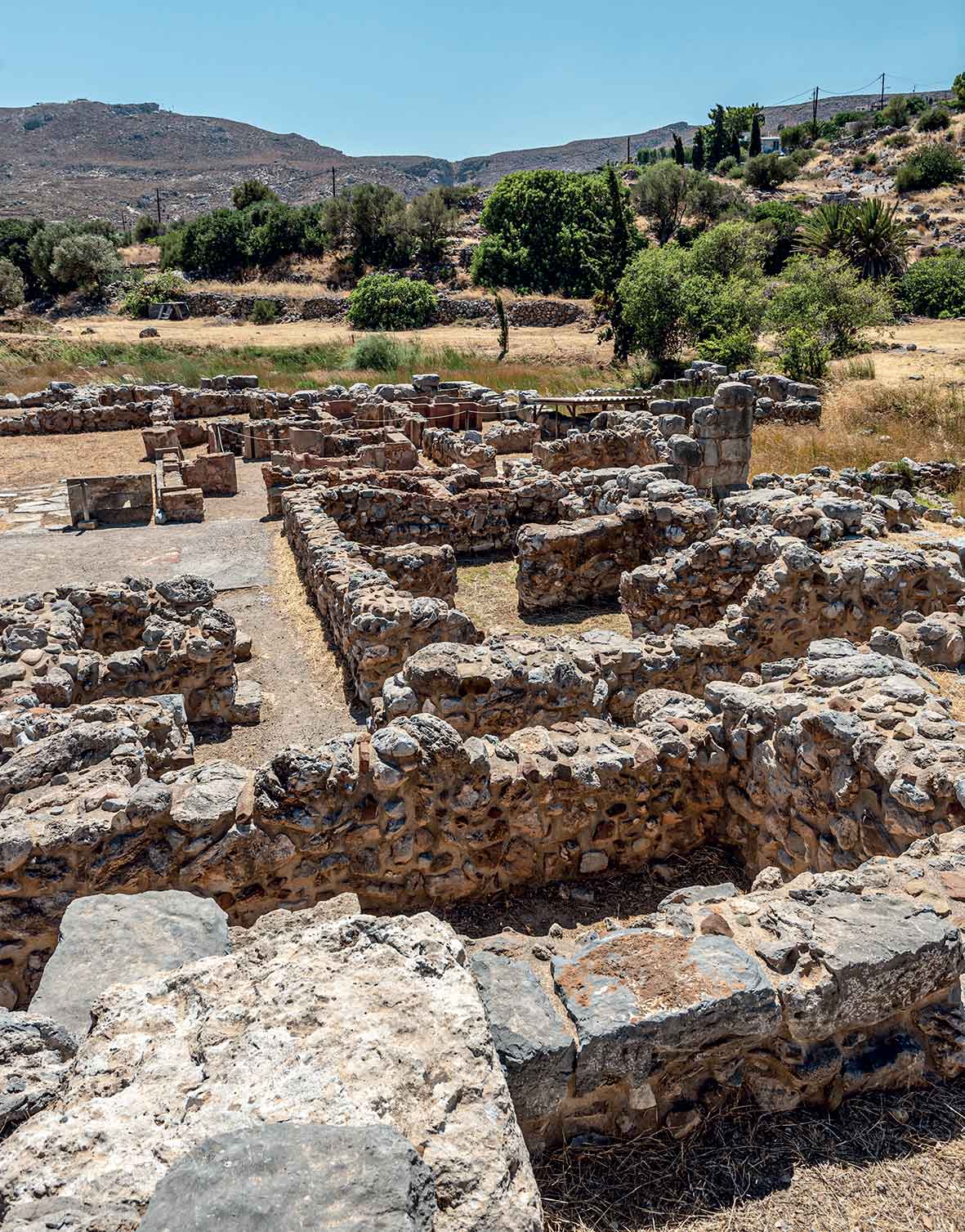
The archaeological site of Kato Zakros.
© Giannis Chatziioannou
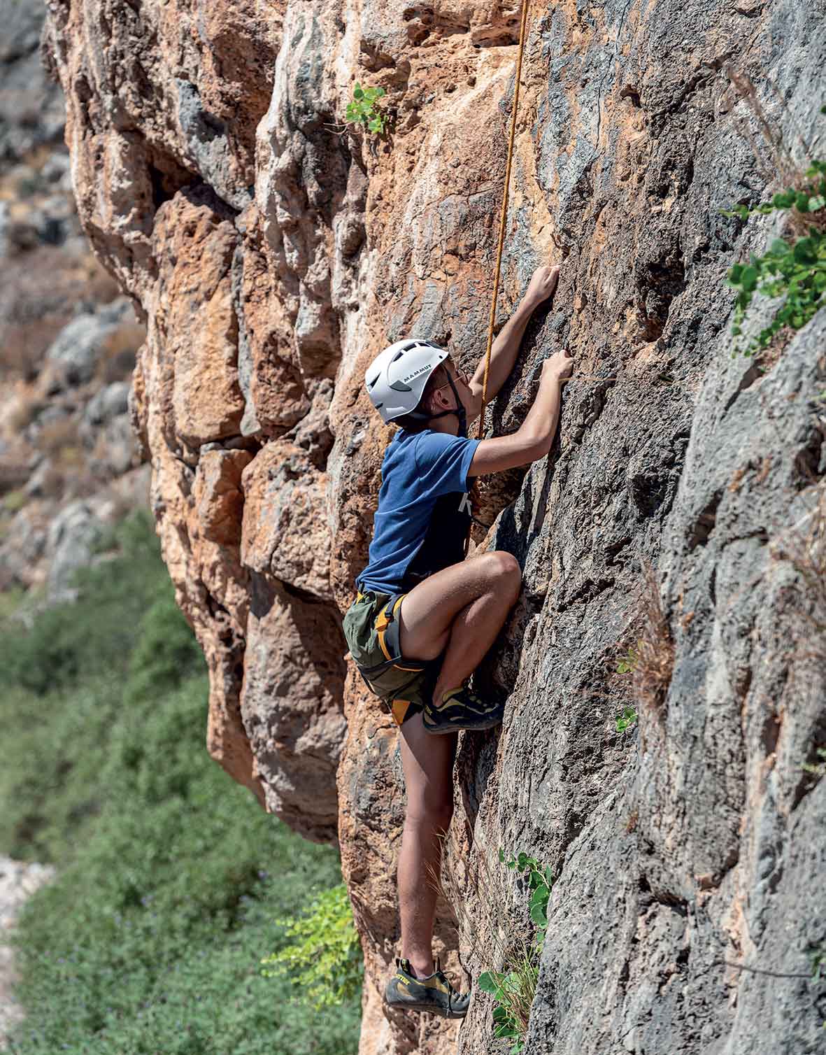
Rock climbing in the Gorge of the Dead in Zakros.
© Giannis Chatziioannou
It may sound a little scary, but it’s loads of fun. The Gorge of the Dead in Zakros, with its reddish-brown rock formations, features human-made climbing trails for single or multiple ropes and all experience levels. If you do not climb, you can equally enjoy all the natural beauty the area has to offer. In fact, it is the ideal location for various excursions throughout the Sitia region. Try the wonderful hike through the impressive gorge from Pano Zakros to Kato Zakros: with a duration of two hours, it forms part of the E4 and is dotted with caves featuring Minoan tombs – hence, its name.
You must visit the archaeological site of Kato Zakros, where you will find the fourth-largest Minoan palace in Crete. This important harbor communicated directly with the East. The only court to have been discovered intact, a series of valuable artifacts were excavated here in 1960 – from jewelry and kitchenware to pots filled with objects. They say the city was suddenly destroyed by a tsunami and that residents abandoned the settlement, leaving everything behind. You can also visit the Museum of Natural History to learn about the Geopark’s geology, flora and fauna, carefully visit the Pelekita cave (20 minutes hike from Kato Zakros) or alternatively enjoy the wonderful beach and its quaint tavernas.
Zakros is 44km from Sitia. The archaeological site, Tel. (+30) 28430.268.97, 08:00-20:00 / Natural History Museum, Tel. (+30) 28430.405.40. For the Natural History Museum, equipment, or communication with mountain guides to help you with any activity, contact the Sitia Geopark, Tel. (+30) 28430.292.22 and (+30) 28430.237.75.
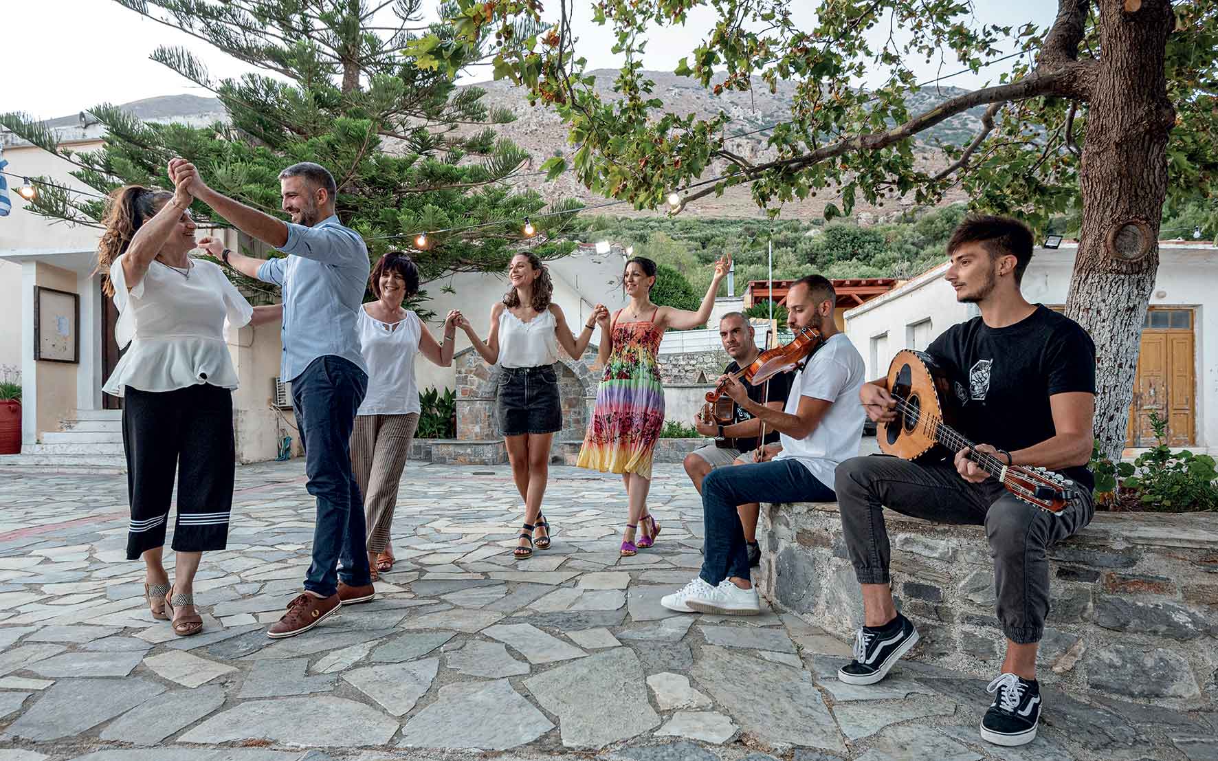
Dancing in Hrisopigi Square.
© Giannis Chatziioannou
One step forward right, one step forward left, short step right, jump: Giorgos Benovias, president of the Hrisopigi Cultural Association, tries in vain to teach us the famed jumping dance from Sitia. In 2018 it was included in the UNESCO list of Intangible Cultural Heritage on the Sitia Lyceum Club of Greek Women initiative. This group works for its preservation and promotion.
The young locals begin playing the violin, mandolin, lute, and guitar; the party starts in minutes, and, as always, everyone is invited. The kontilia melodies echo beside the church, blending with the psalms of Father Manolis and warming up the atmosphere – in eastern Crete, music and people are characterized by an excess sweetness and goodness, as the locals say. The dancing begins with a slow and steady pace, like a warm-up, in time with the violin player and within a few minutes begins to speed up with the music, until the climax: sharp movements by the two front dancers, usually a man and a woman, and some improvised moves that are always modest and low – towards the ground, despite being called a “jumping” dance. This dance is associated with festivals as well as everyday celebrations. It may be found in every village – the one at Hamezi is considered one of the most special, as every resident joins in. However, it is difficult to learn as it is a challenging dance.
Hrisopigi is located 28km from Sitia.
Once upon a time, from the early Minoan to late Byzantine times, the exotic islet of Koufonisi (or Lefki) was inhabited. In fact, it was one of the most important centers for fishing and the export of porphyry, the famous red dye that colored imperial garments produced from the Murex trunculus shell. The entire settlement prospered here, on the fringes of Europe, in front of the crystalline waters of the Libyan Sea. Its strategic position was why the ancient cities of Ierapitna and Itanos fought over the dominance of this little island.
It is here, in the present day, next to the ancient stone theater that seated 1000 people, in the ruins of the Roman baths and the mosaics from a mansion in the adjacent settlement that has been abandoned to wind and sand, that you will enjoy one of the best swims of your life. The temple with a colossal statue was located in the south, of which minimal ruins remain as building materials from this temple were used to build the nearby lighthouse. Uninhabited from the 4th century onwards, it preserved its hidden treasures buried; it was only in 1976 that archaeologist Nikolaos Papadakis began excavating here.
You can visit this island, part of the Sitia Geopark network, by taking a boat from the harbor of Makrigialos or Goudouras. Sailing around the island will reveal wild rock formations and remote caves while you will swim in the exceptional waters of Kamareles, Asprougas, and Hiliaderfia beaches. A unique experience.
Makrigialos and Goudouras are located 26 and 40km from Ierapetra.
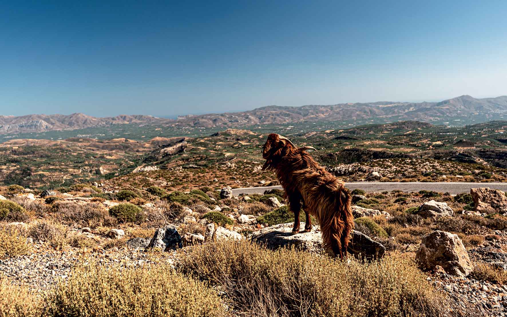
Psiloritis Geopark
© Giannis Chatziioannou
When one hears the word “Anogia,” one imagines strongly built Cretan men with guns and turbans, who turn their “l’s” into “r’s” and are proud of Nikos Xylouris. Rightly so. You will indeed find them here, living up to this reputation. Yet you will also encounter the actual cultural practices of shepherds that developed on the slopes of Mount Psiloritis centuries ago, now set to be included on UNESCO’s List of Intangible Cultural Heritage.
This cultural mosaic is composed of many tesserae, which you will experience with all your senses: the antikristo, a traditional way of cooking meat; the coffee at Grylios’ traditional kafenion; the mantinades (local folk songs) about pastoral life; the moral codes and traditions you will discover; the lyres and Cretan laouto (given that this village is the birthplace of many fine Cretan musicians. You may visit the “Topos tou Voskou” (the shepherd’s place), a cultural space that, in addition to being a reconstruction of a mitato (stone-built shepherd’s hut), also hosts workshops and events. You will also find authentic mitata here, identical to the domed tombs in the Nida Plateau, as well as the cave Idaion Andros.
Walk along the barren mountain slopes to the summit and the Timios Stavros chapel (approximately four hours from the plateau), with eagles floating above your head. After this, you will understand why all these songs were composed here, and why the people of Anogia are who they are.
Anogia is located 37km from Iraklio. “Topos tou Voskou,” Tel. (+30) 697.472.2311.
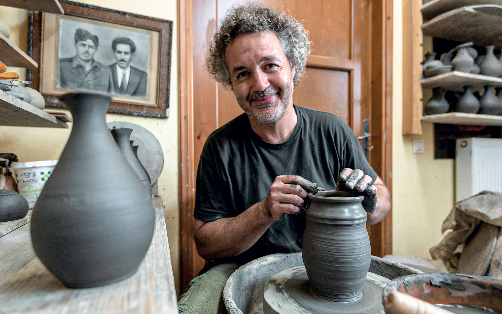
Taditional ceramics workshop in Margarites.
© Giannis Chatziioannou
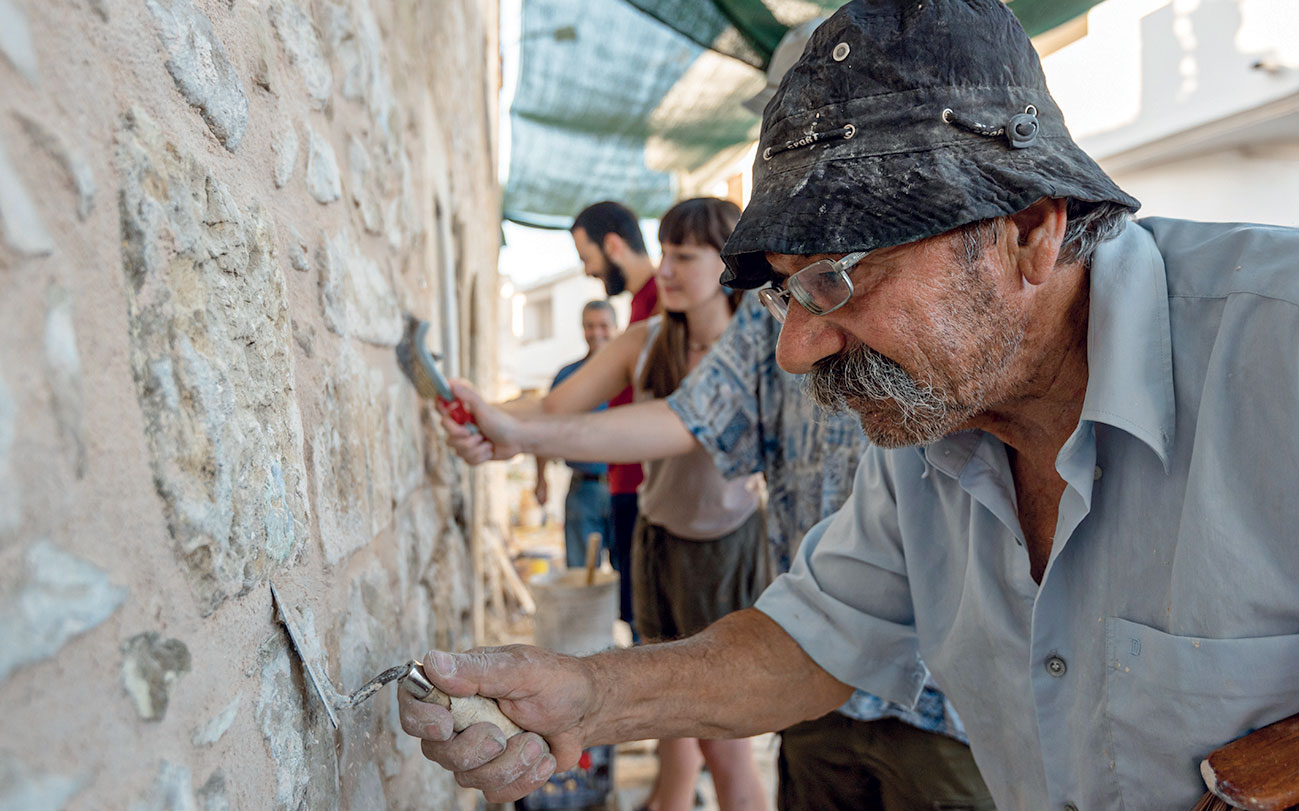
The tradition of dry stone walling lives on.
© Giannis Chatziioannou
Margarites village is famous for its ceramists. With approximately 20 ceramic art workshops in operation, it not only preserves this ancient art but also boasts a reputation as one of the world’s largest ceramic art centers, according to the locals. Visit Giorgos Dalamvela’s Kerameion, where lessons are also offered, and the workshops of Konstantinos Gallios and Frenchman Daniel, who also makes clay musical instruments. However, since 2017, thanks to the newly founded “Rodakas” group, Margarites village is also set on preserving the art of making xerolithia, the characteristic dry stone walls. Local stonemasons offer lessons to those interested in stone carving while also repairing the village walls.
Margarites is 25 kilometers from Rethymno. The next workshop by “Rodakas” will take place 22-28/10. Register online at rodakas.org (link in Greek).
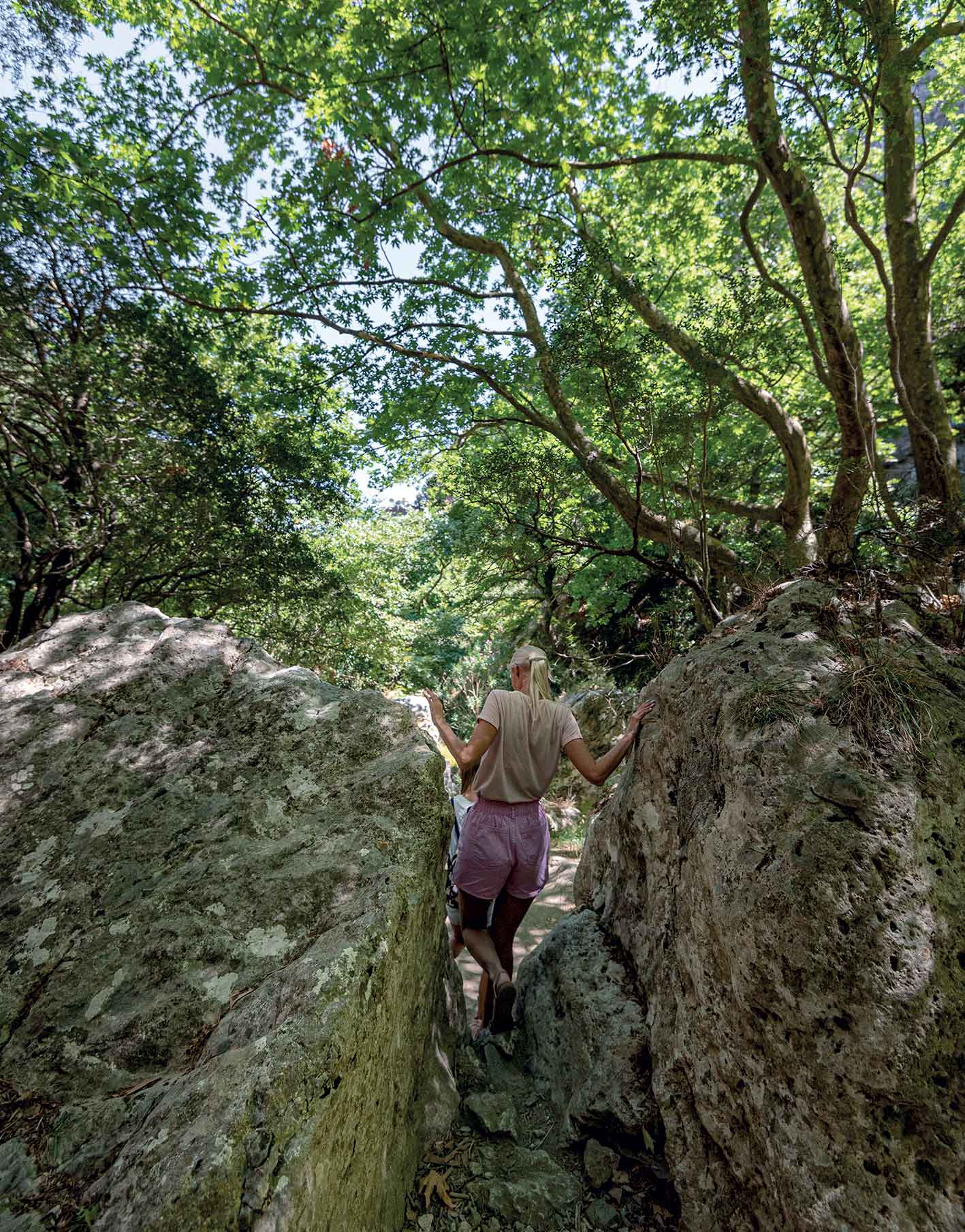
Hiking in Patsos
© Giannis Chatziioannou
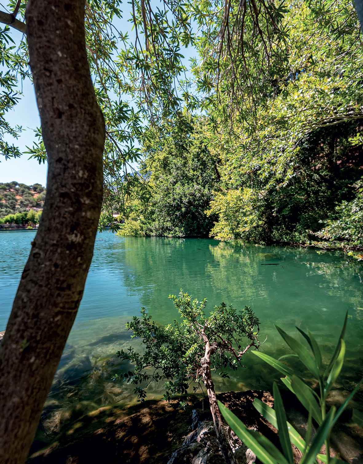
Lake Zaros
© Giannis Chatziioannou
Boasting giant plane trees, endemic Verbascum thapsus (mullein), running waters even in summer, impressive rock formations, and religious monuments, the Patsos gorge is among the most popular in Rethymno. Its main attraction is the cavernous temple of Aghios Antonios, a place of worship since antiquity.
The route begins from Drymos taverna and quickly brings you to the chapel, with its countless votive offerings and pieces of paper hanging from trees or scattered across the rocks. The route to the narrowest part of the gorge is relatively easy (approximately 30 minutes), but you’ll reach a point where there seems to be no way through. Should your physical condition be prohibitive, you should turn back. Alternatively, you can carefully climb the rocks or wade through the river as you descend to the Potamon dam (almost 1.5 hours), the great lake of the Amari area.
The Patsos gorge is 22km from Rethymno. For an organized and safer descent and other activities, contact Wild Nature Camp Tsakalakis, Tel. (+30) 28330.228.88, wildnature.gr.
A veritable jewel with precious treasures nestled in olive groves, grapevines, and cypress trees. The Museum of Ancient Eleftherna, the only museum located inside an archaeological site in Crete, is making a dynamic presence in the cultural events at Rethymno thanks to the vision and efforts of Nikos Stampolidis, head of excavations on the site. The exceptional exhibitions, featuring modern audiovisuals, are evidence that one of Crete’s most important ancient cities was located here, dating from the Geometric period. The archaeological site comprises various sections traversed by footpaths, leading to the Acropolis of Pyrgi and the necropolis.
If all this wasn’t enough, the museum is particularly active, organizing many events and educational programs. It is currently hosting the exhibition “STOLA – a garment of the soul,” which came from the photographs of Vaggelis Kiri and the embroidery of Anatoli Georgiev (26 artworks – of the 140 garments in total – with traditional costumes from Crete to Asia Minor). The exhibition, originally scheduled to run until September 20, will be extended to the end of October.
The Museum of Ancient Eleftherna is 22km from Rethymno. Tel. (+30) 28340.925.01, mae.uoc.com, daily except Tuesdays, 10:00-18:00.
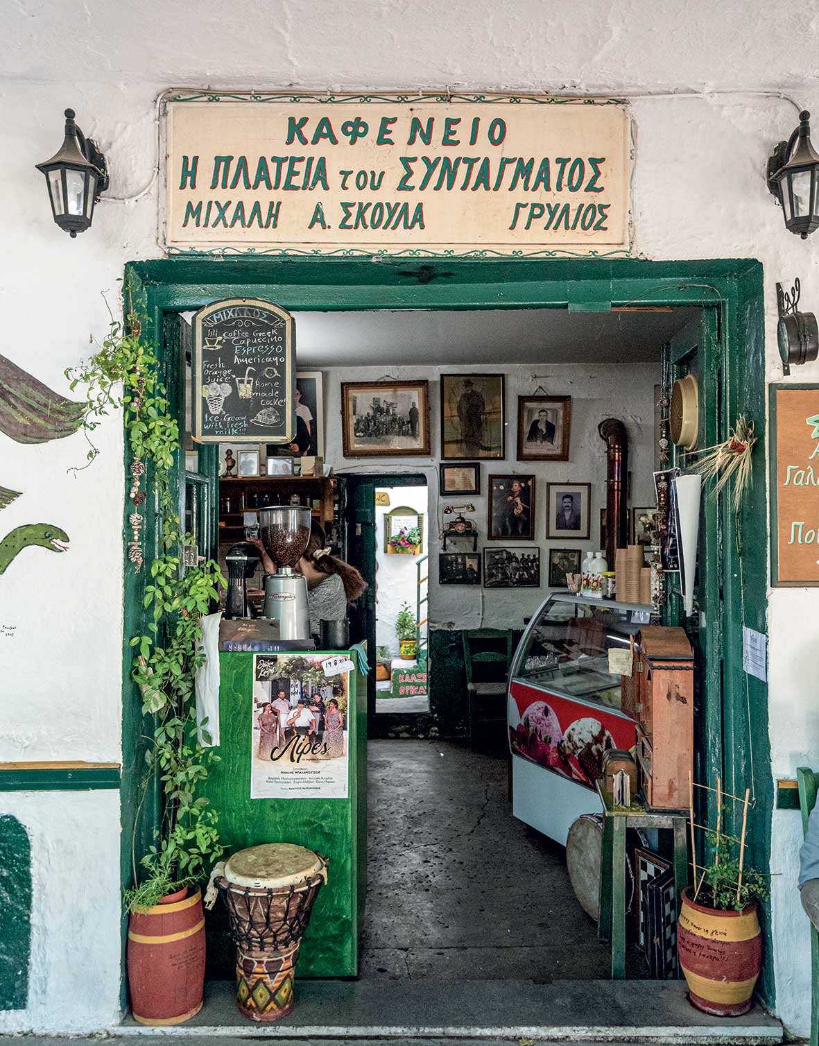
Anogia
© Giannis Chatziioannou

Oasis, Kalo Nero
© Giannis Chatziioannou
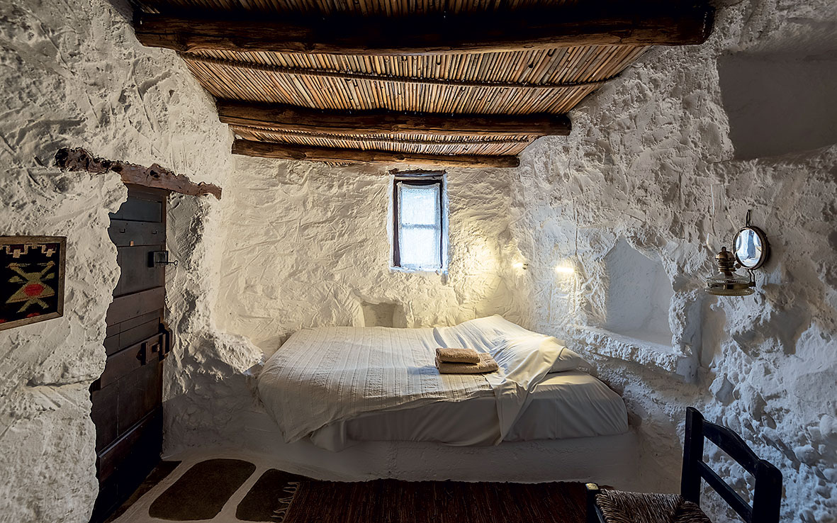
Aspros Potamos Houses
© Giannis Chatziioannou
The island of Crete is famous for many things, including its lakes. Zaros Lake, on the slopes of Mount Psiloritis, does offer a different type of experience, especially in combination with a hike towards Rouvas Forest, allegedly the only kermes oak forest in Europe. The kermes oaks have outgrown their traditional hedge-like form and have become actual trees. Of course, other tree species exist, such as maple trees and the endemic Cretan zelkova.
After enjoying a peaceful stroll around the lake, created in 1987 from the waters of the Votomos springs, follow the footpath to the Aghios Nikolaos gorge, which leads to Rouvas Forest and the chapel of Aghios Ioannis after five kilometers. You will likely come across a local celebration, as locals often come here via the rough dirt road. In fact, the chapel celebrates its patron saint on September 23, and a panigyri (traditional festival) also takes place here.
If you have a four-wheel drive vehicle, drive up to Anogia, winding through the impressive slopes of Mount Psiloritis. You’ll take in a fantastic rocky landscape with abandoned mitata and goats that disappear from sight at lightning speed.
Lake Zaros is 50km from the city of Iraklio.
Transportation
Travel to Sitia by plane from Athens via direct flights with Aegean (aegeanair.com); fares from 70 euros. Alternatively, by ferry to Iraklio from Piraeus, with Minoan Lines (minoan.gr) and Blue Star Ferries (bluestarferries.com) in 9 hours (from 36 euros). Sitia is 125 kilometers from Iraklio (2 hours by car).
Travel to the Psiloritis Geopark by plane from Athens direct to Hania or Iraklio with Aegean Airlines and Sky Express; fares from 78 euros to Hania or from 58 euros to Iraklio.
By ferry to Iraklio or Hania, from 36 and 45 euros, respectively, with Minoan Lines or Blue Star Ferries, 9 or 8 hours.
All prices refer to one-way travel.
Accommodation
There are many hospitality choices on offer in various places of interest. Yet, in the broader area of the Sitia Geopark, we recommend Aspros Potamos Houses (Tel. (+30) 28430.516.94, asprospotamos.gr, from 50 euros, breakfast is charged at 8 euros per person), an abandoned glebe near Makrisgialos that was transformed into a guesthouse. Stay in houses dating almost 300 years, made of stone, with straw and reed roofs. The complex’s photovoltaic system provides energy for basic needs such as hot water, but the houses do not have electrical outlets, candles, or paraffin lamps for light. In addition, in Kato Zakros, an option is Terra Minoika (Tel. (+30) 28430.237.39, terraminoika.com, from 130 euros incl. breakfast) with its stone-built villas. Its energetic owners are willing to accompany you on hikes and climbing expeditions or even teach you some traditional Cretan dances.
In the area of the Psiloritis Geopark, we took note of Enagron (Tel. (+30) 28340.616.11, enagron.gr, from 110 euros with breakfast), in the unique Axos village. This ecotourist guesthouse is a perfect place to stay, eat and experience many activities, from hiking to cooking lessons. In addition, the Kapsaliana Village Hotel at Kapsaliana (Tel. (+30) 28310.834.00, kapsalianavillage.gr, from 195 euros with breakfast) is a member of the Historic Hotels of Europe. This former glebe and settlement of the Arkadi Monastery was restored and enriched with new structures, thus acquiring luxury rooms and suites, an open cinema, swimming pool area with a bar and restaurant that hosts food tastings and other events.
Food
Quality food can be found in both areas. Opt for the traditional kafenia in villages for their genuine, humble flavors. We had delicious meals cooked in a wood oven at Oasis taverna (Kalo Nero, Tel. (+30) 697.755.9603). Nearby you will also find Spilia tou Drakou (Ammoudi, Tel. (+30) 28430.514.94), a classic choice in the area. In Kato Zakros, we recommend Nikos Platanakis’ taverna (Tel. (+30) 28430.268.87).
In the Psiloritis Geopark area, you will find exceptional meat in all the tavernas at Anogia, such as at Aetos (Tel. (+30) 28340.312.62). Lovely dishes and ambiance at Drimos (Patsos, Tel. (+30) 28330.613.00) and Moshovolies (Meronas, Tel. (+30) 28330.225.26).
Cretan cuisine lives on from home...
From Neolithic findings to haunting legends,...
This spring, five majestic peaks across...
From Samos to Crete, we've selected...